As I stood at the edge of the Grand Canyon, compass in hand, I realized that understanding the weather is just as crucial as knowing your bearings. I’ve often found myself wondering how to read a weather map, only to discover that it’s not as complicated as it seems. In fact, deciphering those colorful patterns and symbols can be a game-changer for any outdoor enthusiast. Whether you’re a seasoned adventurer or just starting to explore, learning how to read a weather map can make all the difference in your travels.
In this article, I’ll share my own experiences and tips on how to read a weather map, from the basics of understanding high and low-pressure systems to identifying potential storm patterns. You’ll learn how to make sense of weather forecasts and use that information to plan your trips with confidence. My goal is to empower you with the knowledge to navigate the skies as effortlessly as I navigate the trails with my camera, capturing the beauty of nature one frame at a time. By the end of this guide, you’ll be equipped with the practical skills to predict the weather like a pro, and make the most of your adventures.
Table of Contents
Guide Overview: What You'll Need
Total Time: 1 hour 15 minutes
Estimated Cost: $0 – $10
Difficulty Level: Easy
Tools Required
- Computer or Mobile Device (with internet access)
- Pencil (for note-taking)
Supplies & Materials
- Paper (for printing or note-taking)
- Internet Connection (for accessing weather maps)
Step-by-Step Instructions
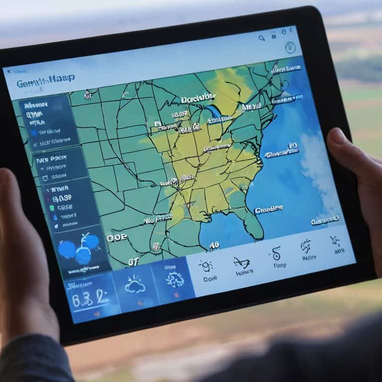
- 1. First, let’s start by understanding the basic components of a weather map, which typically includes isobars, fronts, and high and low-pressure systems. To begin reading a weather map, you need to familiarize yourself with the legend, usually found at the bottom or side of the map, which explains the symbols and colors used.
- 2. Next, identify the geographical area you’re interested in, whether it’s a local region or an entire country. Look for notable landmarks, such as mountains, rivers, or coastlines, to help you orient the map. This step is crucial in setting the context for your weather map reading adventure.
- 3. Now, focus on the isobars, which are lines that connect points of equal atmospheric pressure. These lines can indicate areas of high and low pressure, which are crucial in understanding weather patterns. Notice how the isobars are spaced – tightly packed isobars can indicate strong winds or significant weather changes.
- 4. Move on to identifying fronts, which are boundaries between different air masses. There are cold fronts, warm fronts, and occluded fronts, each with its own set of symbols on the map. Recognizing fronts is key to predicting weather changes, as they often bring precipitation, wind shifts, and temperature changes.
- 5. High and low-pressure systems are also vital to understand. High-pressure systems are typically associated with clear skies and fair weather, while low-pressure systems can bring clouds, precipitation, and stronger winds. Look for the symbols representing these systems on your map, and consider how they might impact your plans.
- 6. To predict weather movements, observe the direction in which fronts and pressure systems are moving. This information can usually be found in the form of arrows or wind direction indicators on the map. Understanding the movement of these weather elements can help you anticipate what the weather might be like in the coming hours or days.
- 7. Finally, combine all the information you’ve gathered to make an informed decision about the weather. Consider the overall pattern of the isobars, fronts, and pressure systems. Think about how these elements interact with each other and with the geography of the area to forecast the weather. This might involve some practice to get a feel for how different patterns influence the weather, but with time, you’ll become more proficient in reading weather maps like a pro.
Decoding Skies

As I delve into the world of meteorology, I’m reminded of my trusty compass collection, which has guided me through uncharted territories. When it comes to understanding weather forecasting symbols, it’s essential to recognize the various marks and patterns that indicate different weather conditions. I recall a particularly fascinating experience where I used isobar maps for weather prediction to track a storm’s movement, allowing me to adjust my photography plans accordingly.
In the realm of meteorology, high and low pressure system analysis plays a crucial role in forecasting. By studying the movement of these systems, you can gain insight into the potential weather patterns that may unfold. For instance, a low-pressure system can indicate an impending storm, while a high-pressure system often brings clear skies. As someone who’s passionate about nature photography, being able to read these signs is invaluable in capturing the perfect shot.
As you become more comfortable with reading weather maps, you’ll begin to notice the distinct characteristics of cold front vs warm front interactions. This knowledge will enable you to make more accurate predictions and plan your outdoor adventures accordingly. By combining this understanding with meteorology basics for beginners, you’ll be well on your way to becoming a skilled weather navigator, capable of tracking storms and predicting weather patterns with ease.
Reading Isobar Maps
As I delve into the world of weather mapping, I’m reminded of my trusty collection of compasses, each one a tangible connection to the thrill of navigation. Isobar maps, with their intricate web of lines, are a fascinating tool for understanding atmospheric pressure. By reading these maps, you can identify areas of high and low pressure, which in turn helps predict weather patterns. I recall a particularly memorable hike, where my ability to read an isobar map allowed me to anticipate a sudden shift in weather, seeking shelter just in time.
To read an isobar map, look for the lines that connect points of equal atmospheric pressure. These lines, or isobars, can indicate the movement and intensity of weather systems. The closer the isobars, the more dramatic the change in pressure, often signaling stronger winds or more severe weather. By combining this knowledge with the forecast symbols I discussed earlier, you’ll be well on your way to becoming a skilled weather navigator, ready to chart your own course through the skies.
Understanding Forecast Symbols
As I delve deeper into the world of meteorology, I’m reminded of the intricate dance between symbols and skies. Forecast symbols are the secret language of weather maps, and deciphering them is an art form in itself. From clouds to winds, each symbol tells a story of what’s to come. I recall capturing a stunning shot of a stormy sky on one of my nature photography escapades, and later, studying the forecast symbols that predicted its arrival.
With my trusty compass by my side, I’ve learned to navigate these symbols with ease. The symbols for precipitation, temperature, and wind direction are particularly crucial in understanding the forecast. By recognizing these symbols, you’ll be able to anticipate the weather conditions, just like a seasoned explorer charting their course through uncharted territories.
Navigating the Skies: 5 Essential Tips for Reading Weather Maps
- Start with the basics: understand the map’s legend to decipher symbols and colors
- Identify high and low-pressure systems, as well as fronts, to predict weather patterns
- Analyze isobar maps to recognize pressure changes and potential storm tracks
- Consider the time frame: consider the forecast period and any warnings or advisories
- Combine your map-reading skills with real-time observations and local knowledge for the most accurate predictions
Navigating the Skies: 3 Essential Takeaways
Always start by identifying the map’s legend to understand the various symbols and colors used, just as I do when preparing for a photography expedition in unfamiliar territories
Isobar maps are your key to unlocking the secrets of air pressure and its impact on weather patterns, so take the time to study them carefully and practice reading them with ease
By combining your knowledge of forecast symbols, isobar maps, and a dash of curiosity, you’ll become proficient in reading weather maps and forecasting the skies like a pro, ready to embark on your own adventures around the globe
Navigating the Skies with Wisdom
As we embark on the journey of deciphering the language of the skies, remember that reading a weather map is not just about predicting the future, but about understanding the present – it’s a dance between the winds, the sun, and the earth, where every symbol, every line, and every color tells a story of adventure, of nature’s fury, and of human resilience.
Lila Wanderstone
Navigating the Skies with Confidence
As we conclude our journey through the world of weather maps, let’s take a moment to reflect on the key takeaways. We’ve learned how to decipher forecast symbols, read isobar maps, and understand the intricacies of atmospheric pressure. By mastering these skills, you’ll be able to predict weather patterns with greater accuracy, making you a more informed and prepared traveler. Whether you’re a seasoned adventurer or just starting to explore, being able to read a weather map is an essential tool in your navigation arsenal.
Now that you’ve gained a deeper understanding of weather maps, I encourage you to venture out and explore the world with a newfound sense of confidence. Remember, the art of navigation is not just about reading maps, but also about embracing the unknown and being open to new experiences. As I always say, the most beautiful moments are often found at the intersection of nature and culture. So, go ahead, grab your compass, and start charting your own course – the skies are full of wonder, and the world is waiting for you to discover it!
Frequently Asked Questions
How do I differentiate between various types of weather fronts on a map?
To decode those fronts, I look for specific symbols and colors on my weather map. Cold fronts are often marked with a blue line of triangles, while warm fronts have a red line of semicircles. Stationary fronts combine both, and occluded fronts have a combination of triangles and semicircles with an alternating pattern – my trusty compass always helps me stay oriented!
What does it mean when the isobars are really close together on a weather map?
When isobars are really close together on a weather map, it indicates a significant change in pressure over a short distance, often signaling strong winds or a low-pressure system. I’ve seen this phenomenon on my nature photography trips, where sudden changes in weather can be breathtaking – and a little intimidating!
Can I use a weather map to predict weather conditions for a specific outdoor activity, like hiking or photography?
Absolutely, I use weather maps all the time to plan my nature photography shoots and hiking trips. By analyzing the forecast symbols and isobar maps, I can predict the best conditions for capturing stunning shots or navigating safe trails. It’s all about deciphering the signs and planning ahead, just like using my trusty compass to find the perfect vantage point.